
Sustainability
- Home
- Locations
- What you can do
- LiFE Framework
- Sustainable Development Goals
- About us
- Grants
- Events
- Contact us
Now searching for:
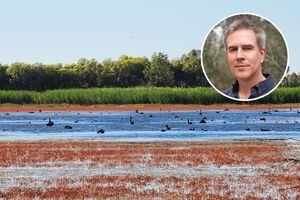
Professor Andrew Hall (inset), Cherax Swamps by Emmalie Sander (Main image)
The Murray–Darling Basin is Australia’s most heavily regulated river system, with dams and diversions disrupting natural flow regimes of its globally significant wetlands. In highly regulated systems, managing environmental water requires precise knowledge of wetland hydro-geomorphological characteristics, yet this information has been largely absent. Charles Sturt researchers addressed this gap by strengthening the evidence base for environmental flow decision-making.
Led by Professor Andrew Hall from Charles Sturt’s Gulbali Institute, the 2025 research produced detailed inventories of hundreds of Basin wetlands using LiDAR topographic data captured when wetlands were predominantly dry.
The results directly informed water planning and environmental flow decisions by State andFederal Governments, advancing evidence-based management to restore wetland ecosystems.
Find out more about
Wetland water flow