25 September 2026
This month, the Smart Grazing, Stronger Lands project team has been on the ground testing an updated satellite-based vegetation cover trigger tool out in the rangelands with pastoralists and grazing businesses.
Dust Watch Australia's John Leys has visited properties at Naradhan, Boorooban, Moulamein and Hay alongside officers from Local Land Services' Riverina and Murray regions, demonstrating how the trigger tool can help landholders monitor vegetation cover trends and identify early warning signs of declining seasonal conditions. Additional demonstrations and farm visits are planned in western NSW over the coming months as the project continues.
The updated Vegetation Cover Trigger Tool (aka VCoTT) – based on the GEOGLAM Rangeland and Pasture Productivity (RaPP) website with additional technological development by CSIRO – combines satellite-derived vegetation cover data with local knowledge to provide an objective indication of when vegetation cover levels may be approaching critical thresholds three to six months ahead. The aim is to give producers more time to consider management options before conditions deteriorate and land condition is placed at risk.
Feedback from participating producers has been overwhelmingly positive, with many seeing the tool as a valuable addition to their existing decision-making processes. Importantly, producers consistently viewed the tool as supporting information that works alongside their experience and local knowledge.
Across the farm visits, participants said the tool aligned well with the way they manage their businesses. Many felt it could provide objective evidence to support grazing, stocking and destocking decisions, while also helping future generations of managers build confidence in those decisions.
A strong theme emerging from discussions was the importance of maintaining vegetation cover and learning lessons from past drought experiences. Several producers reflected on previous periods when retaining stock for too long resulted in paddocks becoming overgrazed and vulnerable to wind and water erosion. For many, the tool’s greatest value lies in its potential to prompt earlier action and help preserve vegetation cover before significant erosion occurs.
One of the most valued aspects of the tool was its ability to show long-term vegetation cover trends. Producers appreciated being able to compare current conditions with previous seasons, including memorable drought periods, and relate the data to their own management experiences. This historical perspective helped build confidence in the outputs and reinforced the tool's practical relevance.
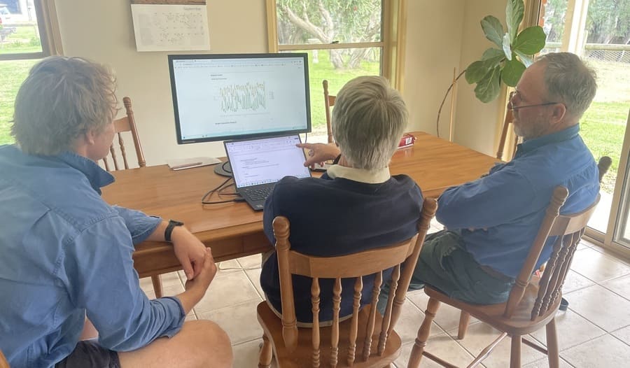
John Leys from Dustwatch Australia (centre) demonstrates the updated Vegetation Cover Trigger Tool to NSW pastoralists
The farm visits also highlighted the importance of trusted relationships in supporting adoption. Existing connections with Local Land Services staff and the opportunity to discuss the tool in the context of individual farming businesses helped producers engage with the technology and explore how it could fit within their management systems.
Hub Program Manager Laura Hassan said, “The Smart Grazing, Stronger Lands project is uniquely bringing together the smarts of the CSIRO, John Leys’ many years of technical expertise, active relationships nurtured by Local Land Services, and the first-hand experiences of rangelands producers to deliver a practical decision-support resource and tool.
“From this first round of producer meetings, we’ve identified opportunities for further development of the vegetation cover trigger tool, particularly around usability and paddock-scale functionality. It’s also confirmed for us that there’s strong interest in having an objective early-warning indicator for declining vegetation cover and that this tool aligns closely with the producers' management goals of maintaining land condition and improving drought resilience.”
The Smart Grazing, Stronger Lands project is supported by the Australian Government through funding from the Climate-Smart Agriculture Program under the Natural Heritage Trust.
The project is led by Adelaide University through the SA Drought Hub in partnership with Charles Sturt University through the Southern NSW Innovation Hub, Grower Group Alliance through the South-West WA Drought Hub, South Australian Arid Lands Landscape Board, DustWatch, CSIRO, NSW Local Land Services, Rangelands NRM, Gascoyne Catchments Group, Southern Rangelands Pastoral Alliance, and the Goldfields Nullarbor Rangelands Biosecurity Association.
Local service providers with grazing management expertise also play a role in delivery.